
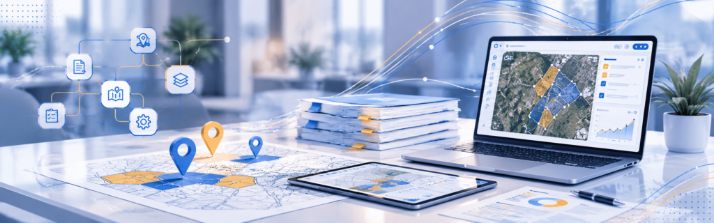
The end-to-end platform for land acquisition at scale
LAMS digitises every stage of the land acquisition and R&R lifecycle — from survey to title transfer — with full compliance, GIS visualisation, and real-time analytics.
Land Acquisition
& Management Platform
The end-to-end platform for land acquisition at scale
LAMS digitises every stage of the land acquisition and R&R lifecycle — from survey to title transfer — with full compliance, GIS visualisation, and real-time analytics.
Industries
Built for
land-intensive
sectors
LAMS adapts its workflows, legal acts, and valuation norms to your specific industry and project type.
Mining Companies
Coal block allocations, tribal land, forest clearances, LARR compliance, and multi-phase mine expansion management.
Infrastructure & Real Estate
Linear acquisitions for highways, railways, and urban infrastructure across multiple districts and states.
Renewable Energy
Solar, wind and hydro project land procurement with lease deed management, KYC workflows, and TSR clearance.
Water Resources
Reservoir submergence, canal alignment acquisition, and large-scale R&R resettlement programs.
Industrial & Logistics
Industrial parks, warehousing hubs, and logistics corridors with multi-plot acquisition and SEZ compliance.
Infrastructure
Land Parcels
Renewable Energy
Process
WORKFLOW
Two powerful process engines
LAMS and R&R workflows work in tandem — covering land acquisition and resettlement from first survey to final settlement.
-
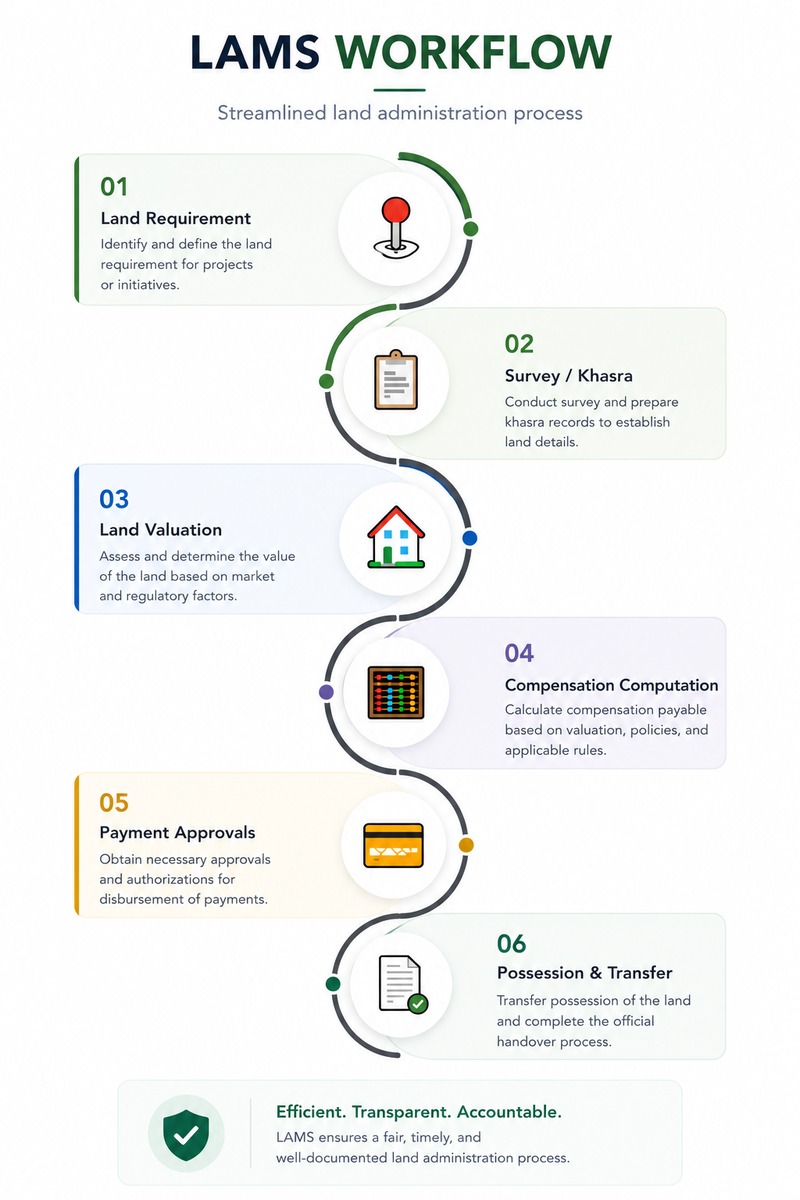
01Land RequirementDefine project land requirements, area specs, acquisition type, and the applicable legal act.
-
20Capture Survey / Khasra InformationDigitally capture plot-level survey data, Khasra records, ownership details via mobile or web.
-
03Land ValuationHorticulture, Forest & Structure valuation by certified valuers with area-wise classification.
-
04Computation of CompensationAutomated calculation per applicable act — solatium, interest multipliers, enhanced compensation.
-
05Payment Process & ApprovalsMulti-level approval workflow with disbursement tracking, bank reconciliation, and audit trail.
-
06Land Possession & Title TransferTrack physical possession handover, revenue mutation, and title transfer across all plots.
-
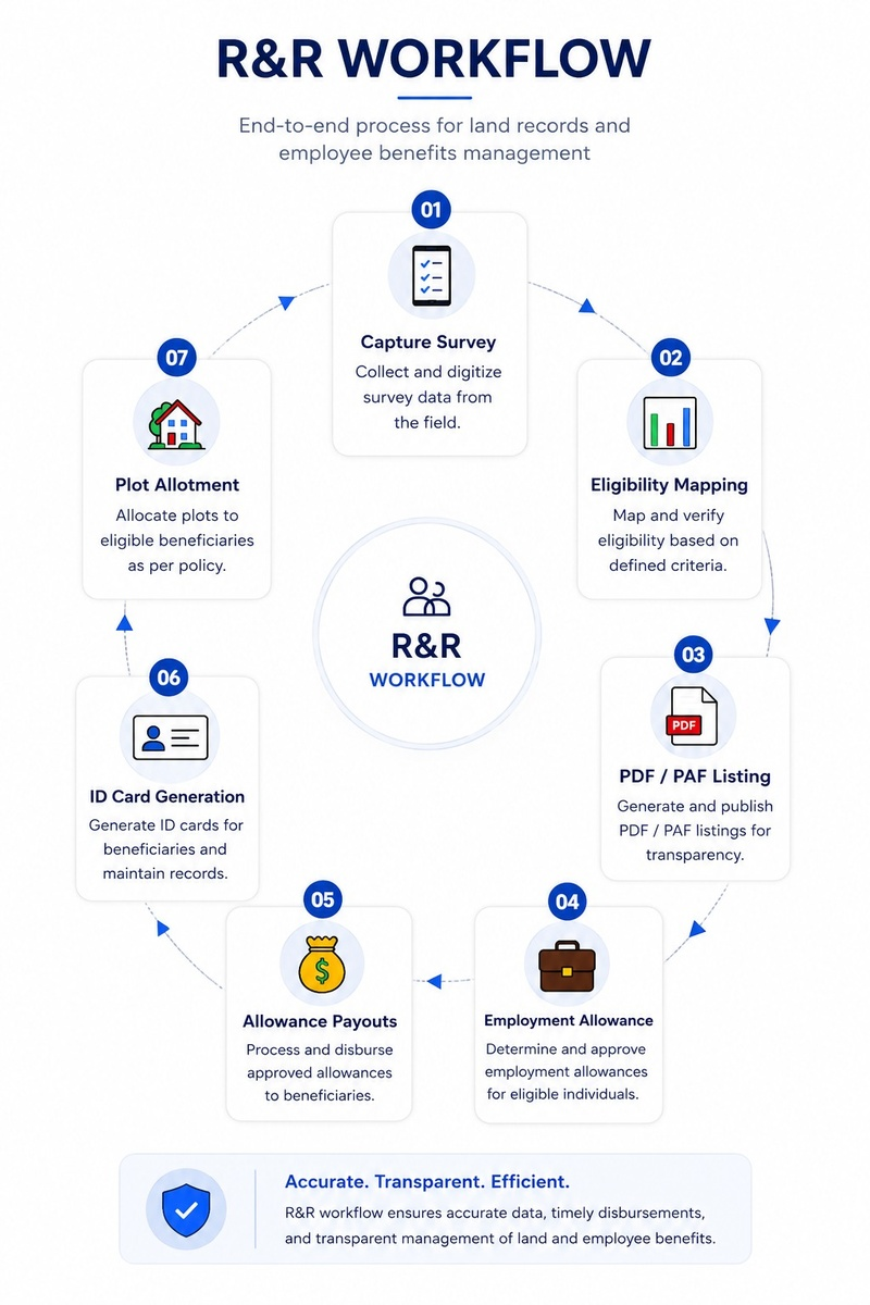
01Capture Survey DataMobile-based socio-economic survey of project-affected families with GPS & photo capture.
-
02Eligibility MappingMap beneficiary entitlements per R&R policy, land category, and family composition.
-
03PDF / PAF ListingGenerate Project Displaced Families and Project Affected Families lists with verification.
-
04Employment & Allowance ManagementTrack employment entitlements, skilling programs, and cash allowances per beneficiary.
-
Allowance PayoutsDisburse relocation, subsistence, and statutory allowances with full digital payment trail.
-
05ID Card GenerationIssue unique identity cards to beneficiaries for service delivery and entitlement access.
-
06House / Plot AllotmentsAllot resettlement plots or houses with deed records and possession documentation.
-
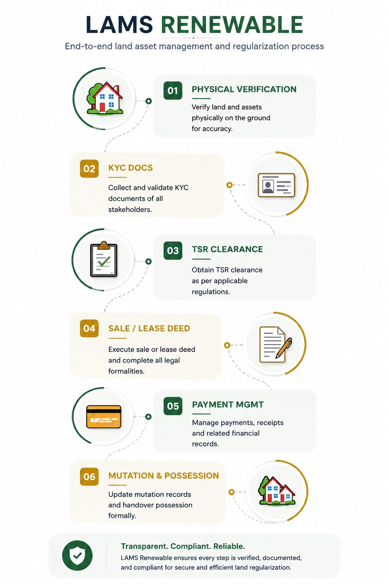
01Land Physical VerificationOn-ground field survey with GPS coordinates, drone imagery, and land-use validation.
-
02KYC DocumentationCollect and verify landowner KYC — Aadhaar, PAN, title deeds, encumbrance certificates via OCR.
-
03TSR ClearanceTrack Title Search Report status and obtain legal clearance within SLA timelines.
-
04Registration of Sale / Lease DeedManage deed drafting, sub-registrar appointments, and digital registration tracking.
-
05Payment ManagementProcess upfront payments, annual lease rentals, and security deposits with audit trail.
-
06Mutation & Possession StatusTrack revenue mutation, physical possession handover, and project site readiness.
Platform Modules
12 integrated functional modules
Every module shares a unified data fabric — no silos, no manual handoffs, complete audit trail.
Foundation & Setup
MODULE 01
User Management
Role-based access control, authentication & permissions across teams and geographies.
MODULE 02
Master Data Management
Configure reference data, land classification, valuation rates & system parameters.
MODULE 03
Land & Ownership Details
Capture survey data, Khasra records, plot info & multi-owner ownership records.
MODULE 04
Acquisition Acts & Process Mapping
Map applicable legal acts (LARR, State Acts) & define acquisition workflow rules.
Assessment & Processing
MODULE 05
Land Acquisition Management
End-to-end acquisition process, statutory notifications & multi-level approvals.
MODULE 06
Acquired Land Management
Track, manage & utilise acquired parcels, encumbrances & utilisation records.
MODULE 07
CSR Management
Manage CSR initiatives, beneficiary programs & community disbursements.
MODULE 08
R&R Management
Resettlement, rehabilitation plans, PAF/PDF beneficiary tracking & entitlement management.
Compliance & Closure
MODULE 09
Legal & Grievance Management
Track court cases, objections, grievance redressal & escalation workflows.
MODULE 10
Payment Management
Process awards, disbursements, bank reconciliation & payment tracking.
MODULE 11
GIS Map Visualisation
Geospatial mapping, plot-level GIS layers, boundary overlays & land-use tracking.
MODULE 12
Document Management
Centralised repository for case files, deeds, plans & records with version control.
Unified Dashboard & Reporting Engine
All 12 modules feed into a centralised dashboard delivering real-time project status, automated MIS reports, audit logs, compliance milestones, and actionable analytics for administrators and decision-makers.
PLATFORM
CAPABILITIES
Built to scale with your ambition
Enterprise-grade capabilities baked into the core — growing with every new project, state, and regulation.
GIS Enabled Plot Management
Interactive geospatial mapping of every land parcel with survey boundaries, ownership overlays, acquisition status heatmaps, and satellite imagery for field verification.
Integration Ready APIs
Modular REST APIs allow seamless integration with government land record portals (DILRMP, Bhoomi, Dharani), ERP systems, treasury gateways, and third-party valuation engines.
OCR Enabled Verification
Optical Character Recognition extracts structured data from scanned title deeds, Khasra records, Aadhaar, and PAN — reducing manual entry errors significantly.
Archival & Repository Integration
Centralised archival of all land case files, legal notices, court orders, deeds, and correspondence with version control, access logs, and retention compliance.
Workflow & Rules Engine
Configurable no-code workflow designer allows teams to define approval chains, SLA triggers, escalation rules, and notification templates — without engineering dependency.
Enterprise Security & Scalability
Role-based access with field-level permissions, multi-tenancy for multiple projects/states, end-to-end encryption, audit trails, and cloud-native horizontal scaling.
Land Survey
Solar Energy
Wind Energy
Industrial
Mobile
Applications
Field-ready mobile apps
Two purpose-built apps extend LAMS to the field and community — offline-first, multilingual, and fully integrated with the web platform.
- Survey App
Field Survey Application
Empower field teams to conduct land surveys and socio-economic PAF surveys on-ground with GPS tagging, photo capture, and offline-first sync — feeding directly into LAMS.
- Khasra & plot-level data capture
- Owner KYC documentation & biometrics
- GPS-tagged boundary marking & geo-fencing
- Offline mode with automatic background sync
- Socio-economic survey for R&R PAF listing
- Photo, video & scanned document attachment
- Landowner Management App
CSR & Grievance Management
Enable landowners and communities to register grievances, track CSR entitlements, and access resettlement status — while officers manage engagement programs on the go.
- Grievance lodging with photo & location evidence
- Real-time grievance & case status tracking
- CSR program registration & attendance tracking
- Landowner entitlement self-service portal
- Multilingual push notifications & alerts
- Officer visit scheduling, reports & geo-tagging
Get Started
Ready to modernise your land acquisition operations?
Schedule a personalised demo and see how LAMS adapts to your industry, legal framework, and project scale — at zero commitment.
Web Platform · Field Survey App · Landowner Management App · Tailored to your industry